


In this issue
Archives
Side Articles
Editors
Hannah Lutgen
Alberto Ricordi
#90 Sustainability & Design (May/June 2026)
Designing With Water
By: Sadie Green
When Kula Kai floods, as it did during the recent Kona low storms, the effects are easy to see: mud-covered roads, overwhelmed culverts, sediment moving across developed areas, stressed wetlands, eroded shorelines, choked reefs, and repeated cleanup costs after major storm events. Less visible is the design challenge underneath it all. As areas have been developed, stormwater has been managed with a focus on conveying runoff efficiently through drainage systems, rather than allowing it to slow down, spread, infiltrate, and be absorbed.
Traditional stormwater design has often been based on historical precipitation volume models. As storm intensities increase, recent storm events indicate that some older drainage systems may be overwhelmed or undersized. Some planning and design approaches emphasize that effective stormwater management does not begin at the bottom of the watershed. It starts much farther uphill, with how land is shaped, planted, paved, connected—or left alone.
This shift also reflects a much older understanding of water in Hawaiʻi. Traditional Hawaiian land and water stewardship practices recognized that upland forests, drainageways, wetlands, nearshore waters, and communities are connected, and the role of managing water across the entire mauka-to-makai system. This perspective aligns contemporary design with place-based knowledge related to hydrology.
This shift in thinking toward ecologically based development approaches is already underway. Across Hawaiʻi, there is growing interest in landscape-based approaches, such as vegetated swales, rain gardens, bioretention areas, contour-based planning, and other strategies designed to align with site conditions and hydrology. Some approaches also focus on restoring natural drainage patterns, increasing infiltration, stabilizing soils, and reducing downstream flooding and sedimentation. Recent Maui County planning materials have also reflected this strategy, including support for wetlands preservation, green infrastructure, and best management practices to address stormwater runoff and drainage issues (1).
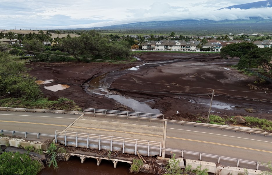
Figure 1. Kūlanihākoʻi Gulch after a major storm event, showing sediment accumulation once again from up mauka. Hundreds of acres of additional development are planned within the gulch’s contributing watershed. Photo credit: Hawaiiansupaman
The Importance of Water in Landscape Design
In Hawaiʻi, the proverb “Ola i ka wai”—water is life—expresses a traditional understanding that fresh water is foundational to life, abundance, and well-being. Adopting this perspective requires acknowledging both responsibilities and benefits. That perspective is relevant today as Maui considers how to treat stormwater as part of a larger living system.
Some drainage systems have been designed primarily around runoff calculation and conveyance - focused on estimating flows, sizing infrastructure, and directing water through a site. With increased storm intensity, traditionally designed systems may become overwhelmed, resulting in increased runoff, erosion, polluted water, downstream flooding, and reduced groundwater recharge.
One design consideration is how a site can hold water longer and release it in ways that reduce potential damage while supporting environmental functions?
At the residential scale, this could include directing roof runoff into planted areas, improving and maintaining healthy soils, reducing unnecessary pavement, planting deep-rooted vegetation, or using small rain gardens and infiltration areas. At the development scale, this may include designing landscapes on contour, preserving gulches and drainageways, creating vegetated basins and swales, and treating open space as part of the water-management system rather than as undesignated or residual land. At the watershed scale, this could include implementing these design techniques to intercept water flows as far mauka as possible, before runoff has a chance to gather volume, speed, and sediment on its way downhill toward the ocean.
In Kula Kai, like elsewhere across the islands, implementing a series of interventions from mauka to makai may provide benefits at multiple scales compared to approaches focused primarily near discharge points. Drainage systems are often layered, distributed, and connected across scales.
A Quieter Shift Is Already Happening
In Maui County, new planning and drainage efforts are beginning to reflect approaches emphasizing on-site retention, infiltration, and vegetation. In some large-property and landscape-scale efforts, strategies such as slowing concentrated flows using check dams, adding vegetated swales and infiltration features, replanting vegetation, and designing around existing topography to increase on-site retention are becoming more common. Many of these practices echo traditional Hawaiian land and water stewardship principles, which recognize water as a shared resource. These approaches often aim to support landscape function in relation to water movement.
The March 2026 storms also provided a visible example of the role natural systems can play. Where wetlands remain functional, they can help slow, spread, and capture runoff, and filter sediment before it moves farther downslope or offshore. Recent reporting and coastal water-quality work on Maui have indicated that functioning wetlands absorb runoff and help reduce sediment and pollutant loads (1).
For landscape architects, owners, and stormwater engineers, considering water within site design has practical implications. This approach may encourage teams to consider how the entire site performs during and after rainfall, as well as how it is connected with other sites and within a larger watershed. It may also increase attention to soil characteristics, plant selection, grading, maintenance, and the cumulative effect of smaller interventions working together. In some cases, reduced water flows may allow the use of smaller hard drainage infrastructure where needed.
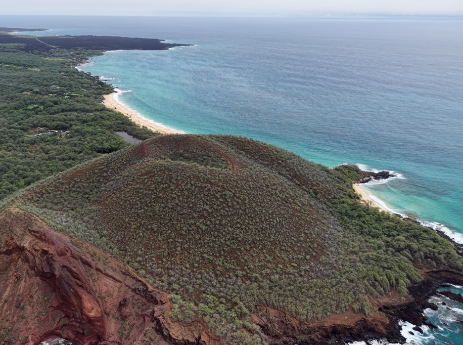
Figure 2. The March 2026 Kona low storms had little impact on waters offshore of Mākena State Park. Sediment-laden runoff was captured and filtered by intact wetlands. Photo credit: Hawaiiansupaman
Why Standards Matter
Although individual projects may help, establishing consistent baseline expectations for how landscapes and developments manage water may provide broader benefits across Maui.
As climate conditions shift and storm intensity increases, drainage standards that once seemed adequate may no longer be sufficient in all locations. For example, in some cases, Maui County Rules for the Design of Storm Drainage Facilities may use storm recurrence intervals of approximately 10 years. Rainfall intensity, vegetation loss, disturbed soils, expanded impervious surfaces, and development in or near former drainage paths can all influence how quickly water moves across the land.
The implementation of modern drainage standards may support that shift by encouraging designs that incorporate predictive flood modeling, promote on-site infiltration where feasible, provide clearer evaluation of downstream capacity, and support long-term planning for landscape maintenance. These approaches may also help connect drainage design with aquifer recharge, wetland function, erosion control, water quality, shoreline conditions, and community outcomes.
Kula Kai Has a Built-In Opportunity
With the 2026 Kona storms behind us, and revised drainage standards and long-term community planning ahead, the South Maui Community Plan provides a setting in which this discussion can continue to develop. Because community plans help guide growth, infrastructure, land use, and public priorities over time, they can also influence how drainage is understood at the landscape scale.
In some cases, draft community plan language includes concepts such as integrating wetlands and drainageways with greenways, incorporating best management practices and green infrastructure, and protecting natural systems. These approaches reflect the connection between land use decisions and water movement. Decisions about development patterns, road placement, impervious surfaces, open space, and drainage corridors all influence how water moves from mauka to makai.
As the Community Plan evolves, it can also be considered as a framework for integrating water into land use planning. When long-range planning supports watershed-based thinking and landscape-based stormwater strategies, it may help incorporate these approaches into routine design and development practices.
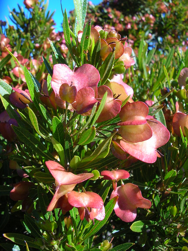
Figure 3. A'alii (Dodonea viscosa), a native Hawaiian shrub, helps stabilize soil and may improve drainage performance. Photo credit: Forest & Kim Starr, Starr Environmental.
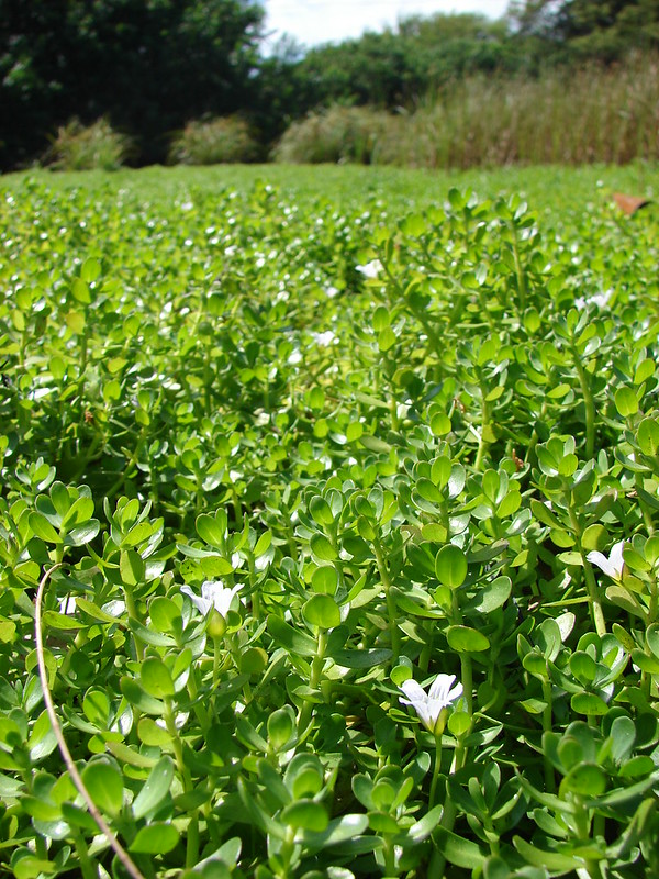
Figure 4. Aeʻae (Bacopa monnieri), a native Hawaiian, sprawling herbaceous plant, helps with erosion control, grows in waterlogged soils or near riparian areas. Photo credit: Forest & Kim Starr, Starr Environmental.
Designing for the Future
Many of these approaches are already well established. Common strategies include slowing runoff, increasing infiltration, distributing flows across the site, protecting drainageways, improving soil conditions, restoring vegetation, and designing along existing land contours. Engineered systems may be used where needed, alongside approaches that enhance the land’s capacity to capture and store water and sediment through soil and plant management. Integrating these approaches into landscape design may enhance water retention and reduce soil erosion and sediment movement to surface waters.
Although flood control is an important consideration, these practices may also contribute to landscape function, long-term performance, and adaptability. Landscapes that absorb water more effectively may also provide ecological and visual benefits compared to systems designed primarily for runoff conveyance.
While this is not a new approach for the landscape and ornamental industry, considering stormwater as a resource presents an opportunity to integrate design, planning, and maintenance. It highlights the roles of restoration, planting, grading, and soil management in supporting landscape performance over time.
Returning to the principle of “Ola i ka wai” does not replace modern engineering but can complement it. It involves applying modern tools alongside established knowledge of water systems. Water management is closely connected to land, coastal, and community conditions.
The rate at which these ideas move from pilot projects and planning concepts into broader policy and everyday practice may influence the future resilience of Kula Kai. Incorporating water-sensitive design approaches may help the region prepare for both routine rainfall and more extreme events.
References:
1. Maui County Planning Department. Wetlands preservation, green infrastructure, and stormwater management guidance. County of Maui, Hawaiʻi.
https://www.mauicounty.gov/
2. University of Hawaiʻi Sea Grant College Program. (n.d.). Wetland mapping, restoration guidance, and coastal watershed planning resources. Honolulu, HI: University of Hawaiʻi.
https://seagrant.soest.hawaii.edu/
3. Hui O Ka Wai Ola. Coastal water quality monitoring reports and stormwater impact observations. Maui, Hawaiʻi.
https://www.huiokawaiola.org/
Sadie Green
Environmental Planner
Maui Tomorrow Foundation
www.mauitomorrow.org
Risking it at Kalaupapa: Tree removal to protect historic monument
By: Ilana Nimz
“That was one of the sketchiest trees I’ve ever climbed.. way sketchier than I thought it was going to be” said climbing arborist Will Loomis of Loomis Tree Care, reflecting on an ironwood tree he removed at Kalaupapa National Historic Park on Moloka‘i. “The trunk was mulch. I didn’t know you could stack mulch that vertically, and the prayers of the Sisters managed to stack mulch more vertically than I’ve ever seen in my life.”
The historic settlement at Kalaupapa is a bit quieter today than in the mid-1800s, when the peninsula was designated as an isolated quarantine area for people with Hansen’s disease (commonly known as leprosy). Hawaiian families had inhabited the peninsula for centuries before the Hawaiian Kingdom moved Hansen’s disease patients to the remote area, fearing the disease would spread to other members of the public. The Board of Health and Sisters and Brothers of the Catholic faith selflessly cared for the patients, risking their own health to serve the people living in Kalaupapa. In 1969, following advances in medical science, the forced quarantine of Hansen’s disease patients was lifted. Many former patients returned to their families on other islands, but several chose to remain in peaceful Kalaupapa to live out the rest of their lives.
Currently, five patients still call Kalaupapa home, and a contingent of Franciscan Sisters lives at the settlement year-round. The grounds are managed by small, dedicated teams from the National Park Service (NPS) and the State of Hawaii. NPS is tasked with maintaining the historic and cultural areas, including the buildings, homes, and landscape. This is no small feat, as the Park encompasses over 10,700 acres, and the historic cultural settlement is about 400 acres. To bolster the skills of the maintenance team, NPS teamed up with Windward Community College to provide a 5-year arboriculture training program to their staff. The program followed the International Society of Arboriculture Certified Arborist guide, with hands-on workshops in tree care and landscape maintenance.
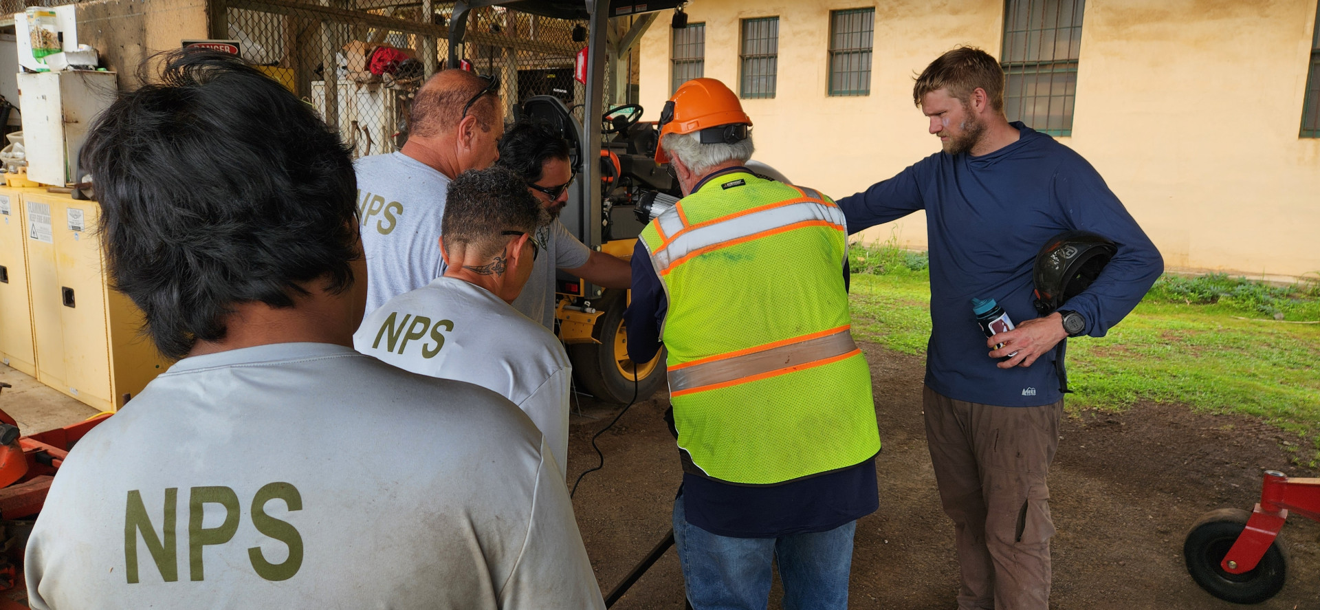
Figure 1. Instructors Steve Nimz and Will Loomis are showing NPS staff how to use the electric chain sharpener.
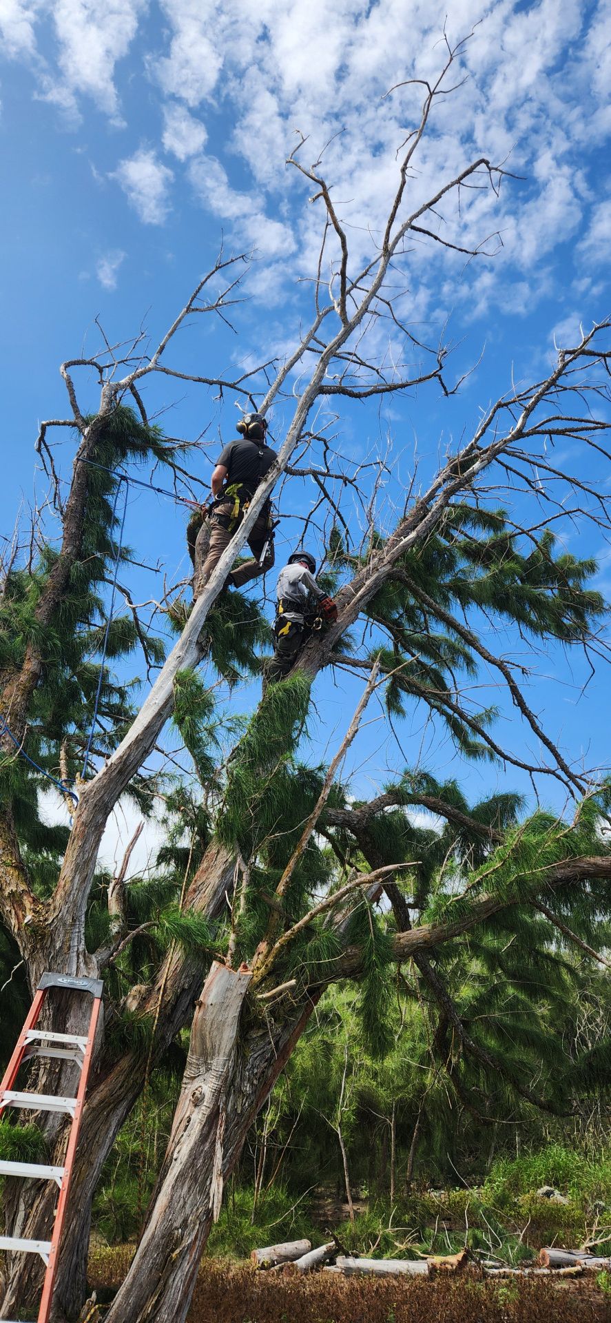
Figure 2. Climbing instructor Will Loomis is teaching NPS staff how to ascend and work in the trees safely.
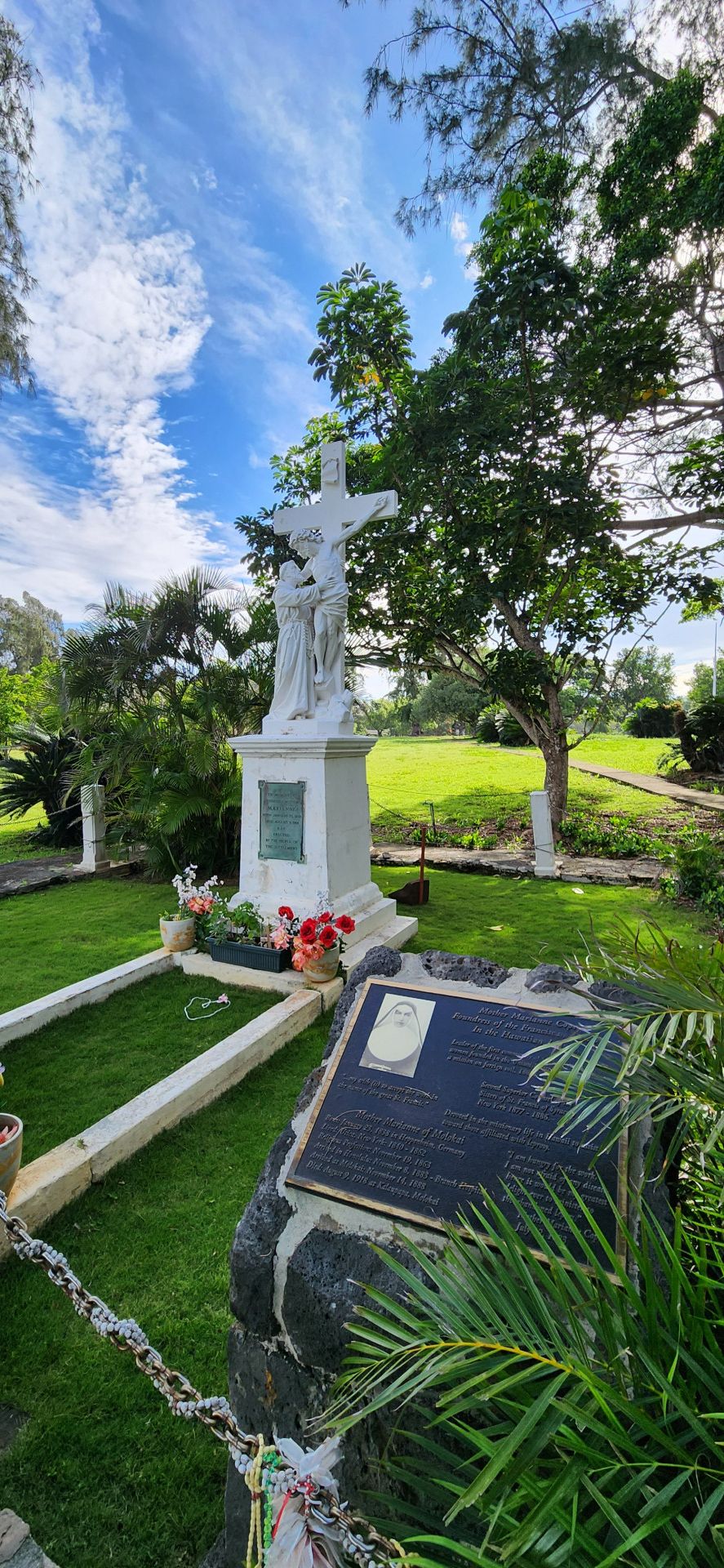
Figure 3. Mother Marianne Monument at Kalaupapa’s Bishop Home. Photo credit: Ilana Nimz.
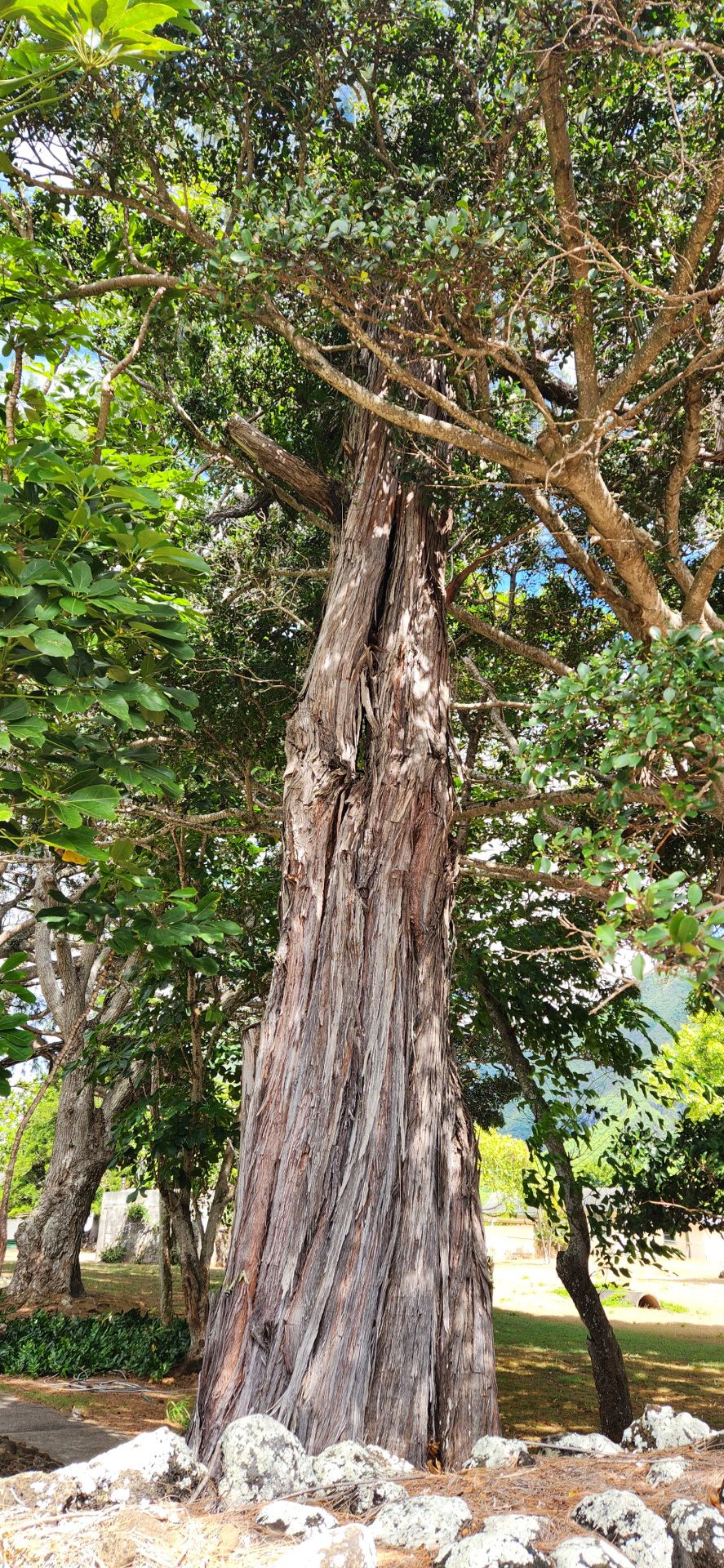
Figure 4. Ironwood tree adjacent to the historic monument. Photo credit: Ilana Nimz.
Of the more than 50 religious congregations asked by King Kalākaua to help out at Kalaupapa in the 1880s, only Mother Marianne and her six fellow Sisters of St. Francis of Syracuse, New York, agreed to go. Marianne established Bishop Home for Girls and Women to serve Kalaupapa’s female patients. She also cared for Father Damien as he succumbed to Hansen’s disease and took over his duties at the settlement. Marianne died in 1918 of natural causes and was buried on the grounds of the Bishop Home. While her remains were brought back to Syracuse in 2005, the monument to her still stands at Kalaupapa, and is an important site for the Fanciscan Sisters that still live in Kalaupapa.
The class examined the ironwood (~50 ft. tall, ~36 in. diameter) that towered over the Mother Marianne Monument and quickly observed that the Sisters were right to be concerned. It goes to show that anyone can be aware of tree risks and report them to improve safety. The tree was cracked and actively splitting. The monument was a target within the tree’s fall zone and would be severely damaged if the tree were to fail in that direction. A historic rock wall was in the opposite direction. The tree was cracked in the lower trunk, and light was visible through the center of the tree. There was also significant decay and branch tearouts in the lower trunk, which were contributing to the tree’s structural decline.
The class determined that failure of the extended branch of the ironwood onto the historic landmark was likely within six months. The consequences of failure would create significant damage to the Monument. The Monument is historic, and repairs would be expensive and challenging to execute due to the remote location of Kalaupapa and the extensive federal archeological process that would be required to complete the repairs. The class recommended that this high-risk tree be removed as soon as possible.
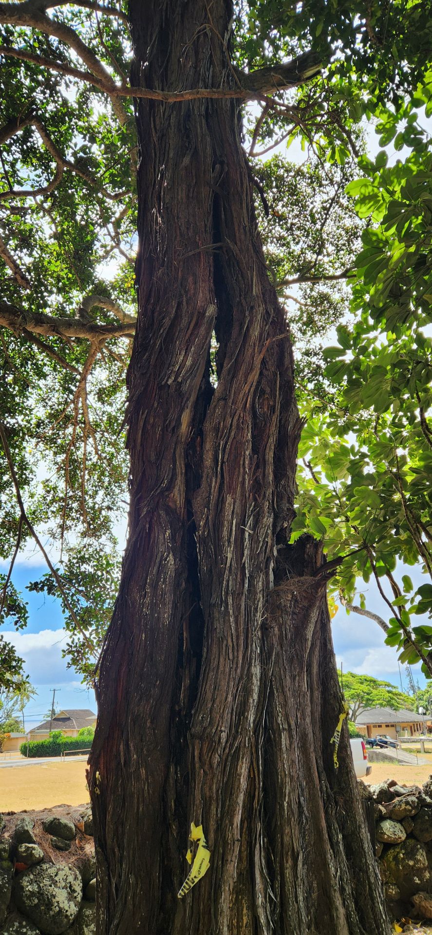
Figure 5. The ironwood tree is split, and the class could see through the tree. Photo credit: Ilana Nimz.
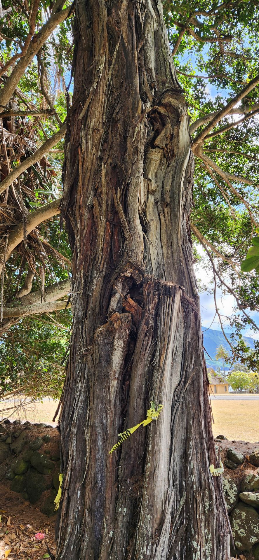
Figure 6. The Ironwood tree has branch tearouts and major decay. Photo credit: Ilana Nimz.
During one of the following arboriculture training sessions, Will Loomis, the climbing instructor, decided he could take the tree out with ground assistance from the NPS class. The staff set up scaffolding and plywood boards around the monument to protect it from falling branches.
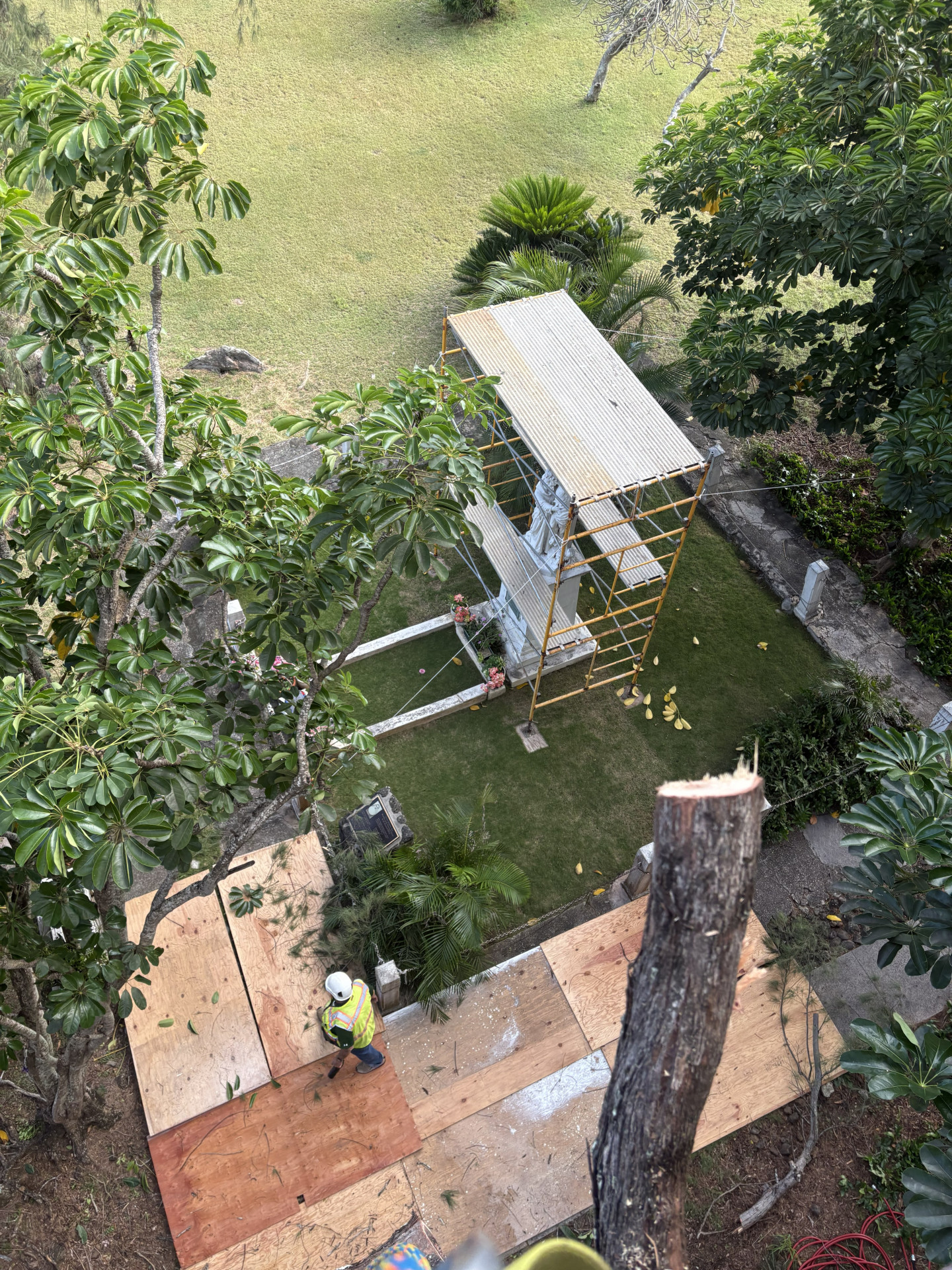
Figure 7: Protecting the Mother Marianne Monument from branch failures. Photo credit: Will Loomis.
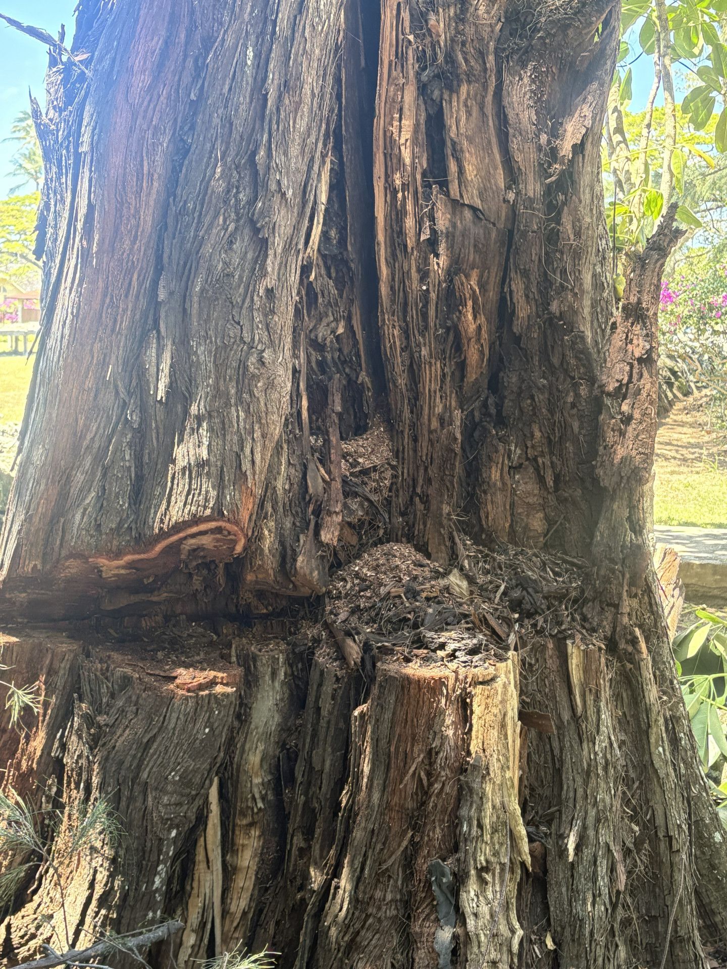
Figure 8. Decayed mulch spilling out of the tree during removal. Photo credit: Will Loomis.
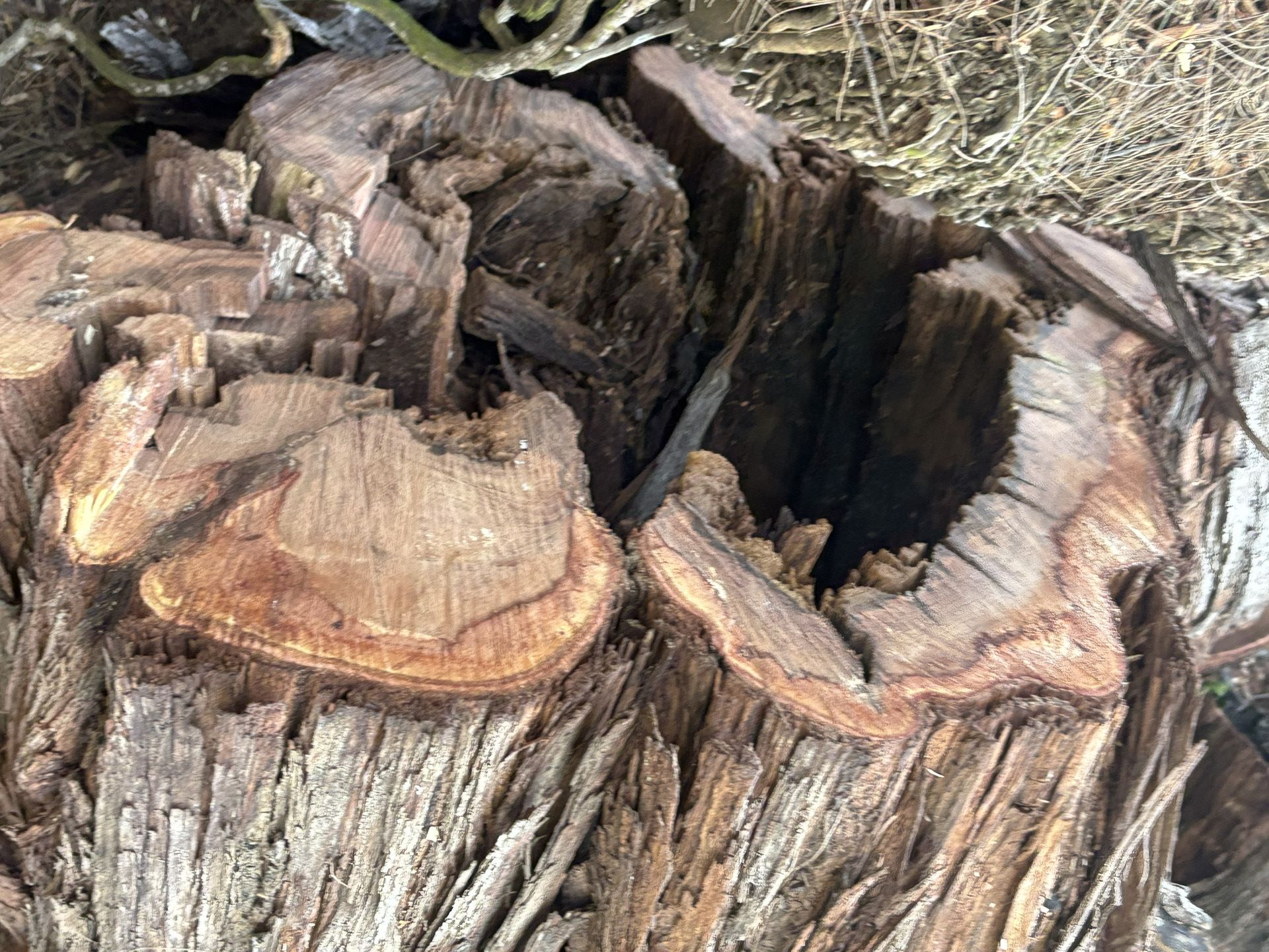
Figure 9: The bright colored wood was the only solid part of the tree- the rest was fully decayed. Photo Credit: Will Loomis.
In 2012, Mother Marianne was canonized, being only the second person serving the Hawaiian islands to receive Sainthood after Father Damian. Though her remains are currently in Honolulu rather than Kalaupapa, her monument is still a pilgrimage site for visitors to Kalaupapa.
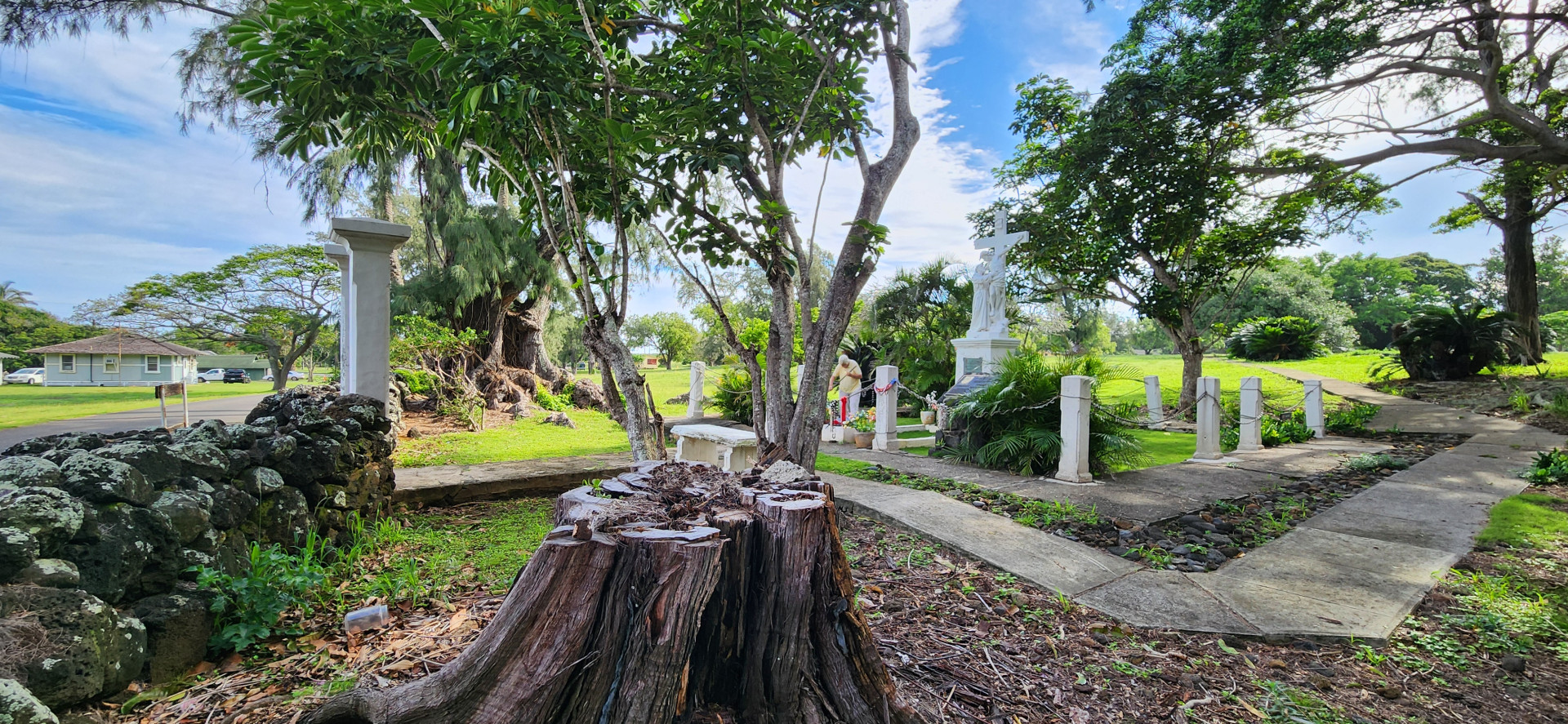
Figure 10. The stump of the Ironwood tree with the Monument behind. Sister Barbara Jean ensures the Monument is tidy and cared for. Photo credit: Ilana Nimz.
Author Ilana Nimz, Arborist for Tree Solutions & Environmental Consulting Services, Inc., has been assisting with arboriculture training classes in Kalaupapa since 2023. Website: TREE SOLUTIONS HAWAII - Home Email: [email protected]
National Park Service at Kalaupapa, Fanciscan Sisters of Kalaupapa, Will Loomis, and Steve Nimz consented to this article.
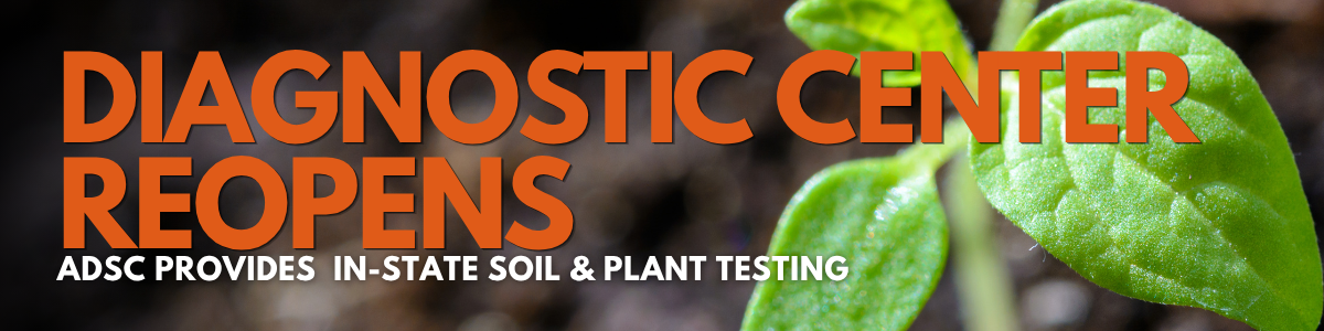
UH's Agricultural Diagnostic Service Center opens for soil analysis, plant disease and insect ID
By Alberto Ricordi
The University of Hawaiʻi at Mānoa College of Tropical Agriculture and Human Resilience (CTAHR) reopened the Agricultural Diagnostic Service Center (ADSC). Soil analysis, plant disease and insect ID have been one of the most requested services by the community. The reopening of ADSC allows local growers, businesses and residents to once again have access to soil and plant testing here in Hawaiʻi, at a reasonable cost, instead of sending samples to the U.S. continent.
The center’s reopening also allows CTAHR to offer free soil and plant testing through July 21, 2026 to farmers whose land and crops were affected by Kona low flooding in March and April. Every affected farmer can submit up to three free samples for each of the following services:
- Soil nutrient analysis: To determine if essential minerals were leached.
- Plant tissue nutrient analysis: To assess the current nutrient uptake and health of surviving crops.
- Plant disease diagnostics: To identify plant pathogens/outbreaks that may impact crops following flooding.
- Insect identification: To monitor for shifts in pest populations following the storms.
Users should complete an online form prior to submitting samples. From the ADSC website, select the type of analysis that you want to submit samples for and click in "Order Services". This will open the online form. After the form is completed and submitted, users will be directed to an online portal to make payments via credit card. Keep your email confirmation to track your submission. Make sure your email and contact information is spelled correctly in order to receive notifications and your sample results.
Collecting, packing and handling your samples
A common question is "How do I collect and handle a sample?". It is very important to collect samples properly in order to ensure the results are a good representation of the area or issue being analyzed. The ADSC website provides general directions on how to collect and handle samples. Here are some resources with directions for properly collecting soil samples and preparing plant tissue and insects for disease identification:
Testing Your Soil - Why and How to Take a Soil-Test Sample (Hue et al., 1997)
Collecting Plant Disease and Insect Pest Samples for Problem Diagnosis (Nelson and Bushe, 2006)
Where to submit samples?
This website lists the sample collection sites in each island.
One important note: plant tissue samples from Oahu must be submitted on Mondays (9am-3pm) and Tuesday mornings (9-11:30am), because samples are shipped to Hilo on Tuesday afternoons to make sure they arrive in the lab before the weekend. This is to prevent samples stuck in the mail or delivered over the weekend, which could lead to samples that cannot be analyzed due to plant tissue decay. To avoid surprises, it is recommended to call your sample drop off location and schedule your sample drop off, to ensure staff is available to assist you and receive your sample.
Do not hesitate to contact the extension agent in your area for assistance. You can find CTAHR's Extension staff in each county using this directory.
Alberto Ricordi, Ornamentals and Landscape Assistant Extension Agent, Department of Tropical Plant and Soil Sciences, Cooperative Extension, Oahu County, CTAHR, University of Hawaii at Manoa. [email protected]
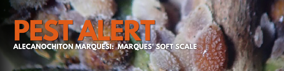
Pest Alert
Please be on the lookout for new plant pest Alecanochiton marquesi, Marques' soft scale. The scale was spotted on Oahu in April near the Hawaii Loa Ridge Trail.
CONCERN
Infests plants in several families, including agricultural, ornamental, and native species. It is unknown where the first establishments in Hawaiʻi occurred, but MSS was first detected on Oʻahu infesting Polyscias lydgatei, an endemic species in danger of extinction. In Brazil and Colombia, MSS is a pest of coffee and sapodilla. Alecanochiton marquesi feeds on phloem sap, and is associated with sooty mold, which weakens plants. In Brazil and Colombia, MSS is often tended to by ants, including Wasmannia auropunctata, the little fire ant (LFA).
IF YOU SUSPECT MSS: Contact the Hawaiʻi Department of Agriculture and Biosecurity ([email protected]) and provide photos and the following details.
INFORMATION TO NOTE
Please note the following information: Island: City/District/Neighborhood: Date: Plant host scientific or common name: If possible, GPS coordinates: Level of infestation (e.g., low, high):
PHOTOS
If possible, take several clear photos: Suggested photos: 1.Host plant – photo of the whole plant and also photos of the section(s) of the plant with scales 2. Zoomed out and zoomed in photos of group(s) of scales from different angles 3.Close-up photos from several angles of individual scales Email photos to: [email protected]
Please see https://dab.hawaii.gov/pi/files/2026/05/MSS_BOLO_2026.pdf for more information.

Community News
LICH PRESIDENT INTRODUCED ON SENATE FLOOR AS GOVERNOR APPOINTEE
On April 21, 2026, the Hawaii State Senate held a floor session at 12:00 PM, where they addressed various legislative measures as the session moved toward its final stages including the introduction of LICH President Matt Lyum by Senator Gabbard as a governor's message appointee. His two-year term on the Department of Agriculture and Biosecurity's Advisory Committee on Pesticides with run through 2028.
 Christy Martin and Matt Lyum, April 21, Hawaii State Senate.
Photo contributed by Christy Martin, CGAPS-Coordinating Group on Alien Pest Species (a project of the Pacific Cooperative Studies Unit, UH Manoa)
GREEN INDUSTRY CONFERENCE NEWS
Early attendee and exhibit registration is now open for the conference on Thursday, October 15, 2026.
Want to be a part of this year's show?
CALL FOR SPEAKERS
Are you interested in speaking or have an idea for a topic? Interested parties are invited to complete a speaker application. If you would like information on sponsoring or exhibiting at this event, please contact us at [email protected]
VOLUNTEER ON THE COMMITTEE
If you would like to join the Conference Tradeshow or Programming committees, contact us.
LANDSCAPE TOUR
Additionally, a Friday tour is being planned. If you have a suggestion for a tour location or would like to assist in the planning of the 2026 tour, please contact us.